Saturday, June 09, 2012

Early Peek at a New Beaver Brook Trail

mountain laurel
tiger swallowtail

What a splendid weekend for mountain laurel. At Beaver Brook in Hollis, NH, it's in full bloom. I went there this morning to join a team that's preparing a new trail, and we spent three hours cutting back laurel & oak & birch along an already-flagged path that might be ready for public use in a couple of years along the northern edge of the property. I won't give details on its location, since it's not quite ready for its public premiere. There are plenty of other Beaver Brook trails to enjoy, and I recommend that you make your way to Hollis to discover them if you haven't already. You can get more information including directions and trail maps at www.beaverbrook.org.

I like to help maintain trails now & then, since I get so much enjoyment out of them all the time. I'm not skilled enough to be an asset on my own, but signing up for an organized trail day like this one lets me work with a team that can get quite a bit done in just a few hours. Keep an eye out for volunteer opportunities in your favorite park. Youth and strength are optional. And if you're lucky, as I was today, there's pizza afterward.

I was wielding a pair of loppers instead of a real camera on this hike, so I had only my phone's low-resolution camera to capture a couple of shots. The tiny photo of mountain laurel gives you the barest hint of the profusion of flowers all over the trail. I saw the swallowtail butterfly when I stopped for a drink of water. It spent five leisurely minutes going from blossom to blossom on a single laurel shrub, apparently unconcerned that I was sitting two feet away.

This is unfortunately a great year for ticks, and I had to brush some off of myself despite using DEET. Anyone in this region who's spent time outdoors this spring knows the drill. We have to put up with them to get near things like stands of mountain laurel.

Beaver Brook is unique in this area in that it's a private holding, not a public park. The Beaver Brook Association is a nonprofit educational organization that owns about 2100 acres of open space, most of it in Hollis, with about 35 miles of trails. The association offers numerous educational programs and guided hikes. Its trails are open to the public every day from sunrise to sunset. Donations to the association are what keep it going, so bear that in mind as you enjoy the trails.

There are several trailheads: a couple on Rt. 130 (which bisects the property), one on Rocky Pond Road, several on Ridge Road, and a couple on the south side near the Massachusetts state line. Take your pick of trails: flat or hilly, ponds or dry woods, lots of company or lots of privacy. The area north of Rt. 130, which includes the area I was in today, is much quieter than the southern side.

Don't let the fact that there are houses nearby keep you from carrying a trail map. Print one out in advance from the web site, or you can purchase one at the association's headquarters on Ridge Road. There are signs but no maps posted at trail junctions. Cell service in the area has improved in recent years, as I discovered to my amazement this morning when one of my companions made a phone call from the trail. I wouldn't count on that to be possible on other Beaver Brook trails, though.

I was part of a good crew this morning, and the weather was fine. I'll look forward to the "grand opening" of this new trail, with its brook & pleasant overlooks. If I'm still blogging when it's unveiled, I'll mention it.




Tuesday, May 29, 2012

New NH North Country Trail Book

I interrupt this southern New Hampshire trail blog for a brief northern foray. I'm happy to announce the publication of 50 Hikes North of the White Mountains, written by New Hampshire's own Kim Nilsen, published by Countryman Press (ISBN 9780881509724, $18.95). Finally, Coos County is getting its due in print. Hikers & campers will love this, of course. I recommend it to anyone who lives in New Hampshire but hasn't yet discovered all the beautiful land north of U.S. 2. If you're already a Coos County fan, you might find some new ideas for your next visit as you browse through this book. Kim's writing is worth reading in any case.

50 Hikes includes a map with each trail description, along with black-and-white photographs. (I'm flattered that Kim chose one of my own photos to illustrate the Prospect Mountain hike.)
A chart in the opening pages shows at a glance the distance and relative difficulty of the fifty hikes, along with notes about suitability for kids and availability of campsites.

I've written in my Cohos Trail journal about Kim's real masterwork, the Cohos Trail. Kim came up with the idea for the trail extending from Crawford Notch north to Canada, and he wrote the original guide to the trail. Now the Cohos Trail Association (www.cohostrail.org) is going strong maintaining the CT's 160+ miles. 50 Hikes includes many segments of the CT as dayhikes, and hike #50 is the full Cohos Trail in all its backpacking glory. The rest of Coos County is not neglected, however, with featured hikes for the Randolph area, the Dead Diamond district, Indian Stream, and Mt. Success.

From my own experience, I can give a few recommendations. The Falls in the River trail (#46 in the book) goes south from the Second Connecticut Lake dam on U.S. 3 in northern Pittsburg. It's a fairly level woods walk that leads to a beautiful flume of the Connecticut River, complete with ledges for a picnic stop. Mount Magalloway (#40) features the northernmost fire tower in New Hampshire, with correspondingly awesome views. The Pondicherry wildlife refuge in Jefferson gets its due in hikes #2 & #3.

Kim is generous with his time for anyone seeking information about New Hampshire's north country, as I learned as I was preparing for a backpacking trip on the CT a few years ago. All that generosity and love for the land comes through in his new book. Find it at your local bookstore (I picked it up at Toadstool Bookshop in Milford), or online at Countryman Press or Amazon.com.


Sunday, May 27, 2012

Odiorne Point State Park

This is the best piece of New Hampshire's eighteen-or-so miles of Atlantic coastline.  Those of you wanting a sandy beach & crowds can travel a few more miles south to Hampton. Odiorne Point is an altogether different experience. With a rocky shore, it's not a big sunbathing destination. What is has instead are trails, a boat launch, a salt marsh, dense woods, a science museum (separate admission), and a few World War II-era gun emplacements (!).  Check out the New Hampshire State Parks web page here for more information.

Located on Route 1-A in Rye, just south of Portsmouth & New Castle, Odiorne Point State Park has a $4-per-person admission fee whenever there's an attendant on duty, as on this Memorial Day weekend. Pack a lunch & enjoy the view to the Isles of Shoals from the picnic area. Bring bikes & strollers, since most of the paths are smooth & flat. The boat launch is a short distance north on Route 1-A from the main park entrance, if you want to bring your kayak. You'll want a camera as well, especially if you're a birdwatcher.

Somewhat hobbled by a tweaked knee today, I walked a slow circuit from the main parking area out to Frost Point, then past one of the concrete gun emplacements to the bike path along 1-A, which led me back to the parking lot. Lots of families were out & about, but there was no sense of being crowded. I was probably the slowest person in the park, and no one seemed to mind.

To get a sense of the different environments in this one small area, take an oceanside walk to feel the breeze & smell the salt air. Then walk away from the shore into the woods - and in just a minute, no more salt air. The fragrance of the woods is completely different. The shade will catch you by surprise, and so will the mosquitoes, unless you pack some bug repellent.

Flowers both wild & cultivated are everywhere. I'm fond of the wild roses that were blooming along the shore path. Clumps of iris stood near markers paying tribute to the park's history. They're not for picking, of course, but I have to admit I was tempted.

Roses along the shore

Monument to the area's first European settlers

Cool & shady path connecting shore trail with paved bike trail

Battery Seaman, a WWII souvenir, seaward view

Jetty at Frost Point, looking north to New Castle

Thursday, May 10, 2012

Gregg Trail: Wheelchair-Friendly, & Good Views for All

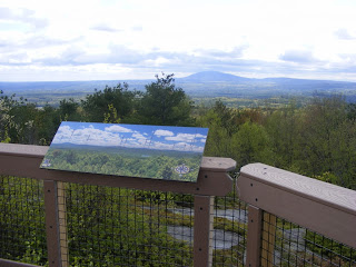
The Crotched Mountain Rehabilitation Center in Greenfield built two trails on its property in 2010 that are designed to be accessible for all, including people whose mobility is limited. One of the trails is a short loop around a wetland. I was there today for the longer trail: the Gregg Trail, .09 mile long, leading to a knoll with a view towards Mt. Monadnock. Other trails, rougher and more traditional, continue from there to the summits of Crotched Mountain.

Gregg Trail is wide, with an average 5% grade. Bring the whole family and take your time along the way. There are blueberry bushes all over the place, which of course did me no good today but should be perfect in July. Along the way, look east to the twin Uncanoonuc Mountains in Goffstown and the whaleback-shaped Joe English Hill in New Boston. As you approach the knoll, you'll see North Pack Monadnock and Pack Monadnock to the south. Finally, as Monadnock comes into view, you'll see all kinds of hills that will make you wonder what's what - and fortunately, there's an illustration nearby that names each peak.

No dogs allowed except for service animals. Sorry, Fido.

Head north out of Greenville center on route 31 and look for the blue Crotched Mountain sign at an intersection. Turn right and follow the road uphill about a mile and a half to the rehab facility, and you'll see the trailhead on your left. There are picnic tables and a porta-john along with a map kiosk at the trailhead.

Summit of Crotched Mountain, from Gregg Trail

View of Mt. Monadnock from end of Gregg Trail

Monday, May 07, 2012

Northwood Meadows State Park

Meadow Lake, Northwood Meadows State Park

Turtles basking in the mid-spring sun
No crowds here. Northwood Meadows State Park is the essence of passive recreation. The park is easy to find on Route 4 in Northwood. The main trail from the parking area is the north end of a 5-mile network of trails linking the park with other parcels of public land. Information  including a map link is here.

This is one of the newer state parks, and its wide & flat main trail was originally developed to be suitable for wheelchair users. The walk from the parking lot to Meadow Lake, this park's little jewel, takes only about ten or fifteen minutes at an easy pace.

This is an unattended park, with no staffer at the gate to collect a fee. I was surprised there was no box for donations, but perhaps security is a concern. I saw a few blazes & little cairns but no trail signs. Print out the trail map before you go; the map box was empty today.


Saturday, May 05, 2012

Ice Cream & Columbines on the NRRT

Back to the Nashua River Rail Trail today. This is still one of my favorite places, in all seasons. After a dry winter & early spring, recent rains have brought out the wildflowers along the trail, including the columbine pictured below that will be gone by my next visit. Today's walk was from Gilson Road in Nashua to Rt. 113 in Pepperell.
Trailside oasis in Dunstable

Basking turtle, trailside marsh

Rail Trail Ice Cream Stop, Pepperell: this is "Small"

Hardly any traffic on the trail today!

Columbine & bluets

Monday, April 30, 2012

Forest Society HQ in Concord


The Society for the Protection of New Hampshire Forests headquarters is in Concord, about a ten-minute ride from the State House off of exit 16. Follow signs for "conservation center", and you'll find the headquarters on Portsmouth Street. Stop in the foyer at the main building to pick up a map with the title Merrimack River Outdoor Education and Conservation Area, then drive another quarter mile down Portsmouth Street to a parking area and trailhead on the left. Don't expect the map box at the trailhead to be stocked.

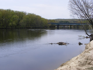
The Forest Society trail network at this property runs along the Merrimack River (photo shows view upstream to I-93) and includes a pine plantation, a silver maple forest (forming the natural archway in the photo above), floodplain, and a river cove with a canoe landing. The traffic sounds from nearby I-93 are easy to ignore. In this drought, the river is quiet, but the sharply-cut banks indicate how high the Merrimack can run in a rainy season.

I stayed here longer today than I had intended, stretching a quick lunchtime walk into an hour. The trail is flat & sandy; no boots required. The bugs are out, so bring your insect repellent. This is an undramatic, peaceful spot for a walk, and it's open from dawn to dusk.

Saturday, April 28, 2012

Mason: Parker's to Rail Trail


I took my husband up on his invitation to join him and his running buddies in Mason NH this morning. Beautiful day, lots of sun, 40 degrees or so at 8 a.m. We agreed to meet back in the Parker's Maple Barn parking lot at 9:30, and I left the runners to follow their own paths. I walked toward the rail trail that runs through Mason from the Massachusetts border north to Wilton and then west to Greenville.

Mason has hills. Not steep hills, but hills nonetheless. Brookline Road heading northwest from Parker's makes a steady climb up to County Road and continues fairly level to a sharp left turn. At that point, I went straight onto unpaved Scripts Road, a dead end with no-parking signs all along one side. It's surprising how often no-pavement and no-parking add up to a trailhead.

About ten minutes on Scripts brought me to the dead end with enough space for a few cars to park. A stony little trail disappeared into woods on the right, and I followed it knowing that the rail trail had to be close by. Two minutes later, there it was. A sharp right would have taken me north; I stayed left. You can see from the photo that this is a decently-maintained trail. It's wide as a boulevard, with unremarkable but pleasant woodland scenery. It must make a great snowmobile trail in winter. Equestrians are welcome, though the Scripts Road trail entrance is not the place for a horse trailer. Several other town roads cross the trail and I suspect some parking is available at each intersection.

I turned around 45 minutes into my walk, which took me only a fraction of a mile on the rail trail. I know from long-ago hikes on more northerly segments of the trail that I could have walked in peace all day if I'd had the time. I'm sorry I couldn't stop today at Pratt Pond, probably the prettiest spot on the Mason trail.

Although close to town roads, the trail's peace and quiet are remarkable. Aside from a plane passing far overhead, the only sounds were birdsong and wind in the trees until a pair of runners (hey! I knew those guys!) passed me.

The walk back to Parker's was of course mostly downhill, and I went into that wonderful restaurant for an excellent breakfast with my husband. As is usually the case with Parker's on a Saturday morning, there was a short wait for a table. Believe me, it's worth it. (Try stuffed French toast and a mug of maple coffee. Trust me.)


Wednesday, April 18, 2012

Mine Falls Park: Home of the Gate City Striders

OK, so the park isn't officially the home of a running club, but members spend so much time at Mine Falls Park that it's sort of home-away-from-home.

If you have avoided the Mine Falls area out of concerns for personal safety because it's an urban park, you might want to try the trails late in the day on Wednesdays between now & October. Gate City Striders (GCS) use the park and the adjacent NHS-South track for weekly workouts at 6 p.m., giving you plenty of company on the trails for an hour or so. You can park in the Nashua High School-South lot, behind the school, near the track.

By the way, I've used these trails for years, in all seasons, at all daylight hours & occasionally at dusk. I have not been accosted at any time. The creepiest near-encounter I  had with a suspicious-looking character was in the east end of the park, behind the now-renovated mill buildings, a decade ago when they were still pretty derelict. The character disappeared as soon as a group of half a dozen Striders came into view on their Wednesday run.

I'm responsible for my own safety, so of course there's risk, which I try to mitigate by carrying assorted devices. I usually let someone in my family know where I'm headed. I actually feel more at-risk in urban parks than on remote trails. I don't let the risk scare me into staying home.

Come check out GCS in any case. Fine folk, in my experience.


Saturday, April 14, 2012

North Country View

I spent this uncommonly warm April day driving upstate to Bethlehem, Littleton, and finally Lancaster. This is a blog about southern NH trails, but today's trip was pleasant enough to rate a mention. I took this photo from the auto road up Mt. Prospect at Weeks State Park in Lancaster. The road is closed to auto traffic until sometime later this spring, but pedestrians may leave their cars at the base of the road and walk to the top. This is the view of the Presidential Range from one of the pull-offs along the way.

This has been a very dry winter and spring. As the photo shows, the Presidentials have far less snow cover than is typical for this time of year. I drove through Franconia Notch on my way north, and Cannon's ski trails are merely streaked with snow. (The ski area shut down for the season some time ago.) On the eastern side of the notch, only Lafayette had a snowcap, and it looked unimpressive. The bright side to this drought - and it is definitely a drought - is that the bugs haven't come out yet. I was out for several hours today and wasn't bitten at all.

I didn't walk all the way to the summit on this trip, but I encourage readers to do so if they get a chance. The summit's fire tower is unique. Instead of the usual metal skeleton, this one is a flagstone tower. This is an active firespotting station, and if you're lucky, you'll be there on a day when it's staffed & the cab is open to the public. As you'd expect, the views are outstanding.

The entrance to Weeks State Park is on U.S. 3 in Lancaster, about 2 miles north of the Whitefield town line. Details are available at the NH Parks & Rec web site here.

Tuesday, April 10, 2012

Dry spring = dry trails

Nearly snowless winter & dry spring have left trails near Merrimack in good shape. It's very dry & fire danger is high. Those same conditions have kept bugs away so far, although that can't last for long.

A few of my recent walks:
Pawtuckaway from parking lot near main entrance: I got most of the way to the fire tower before a still-healing fractured toe made me turn back. Some mud, easily bypassed. Main road is still gated and is likely to remain so for at least a couple of more weeks. While the park is not yet staffed for the season, there's now an iron ranger in the parking lot where you can pay $5 for admission. That's a bargain for this huge park with so many features.

Rollins State Park: The auto road up Mt. Kearsarge is still gated, but pedestrians can enjoy the paved road that comes within a half mile of the summit. Some tree litter remains on the road, but there's obviously been some early-season cleanup going on.

Horse Hill in Merrimack: I'm loving these few bug-free weeks on the trails here in Merrimack.

Mine Falls in Nashua: All trails clean & clear. The canal and river are at dramatically low levels.

Get out & enjoy everything. Keep your DEET handy, though. We'll need it soon.