Tuesday, May 29, 2012

New NH North Country Trail Book

I interrupt this southern New Hampshire trail blog for a brief northern foray. I'm happy to announce the publication of 50 Hikes North of the White Mountains, written by New Hampshire's own Kim Nilsen, published by Countryman Press (ISBN 9780881509724, $18.95). Finally, Coos County is getting its due in print. Hikers & campers will love this, of course. I recommend it to anyone who lives in New Hampshire but hasn't yet discovered all the beautiful land north of U.S. 2. If you're already a Coos County fan, you might find some new ideas for your next visit as you browse through this book. Kim's writing is worth reading in any case.

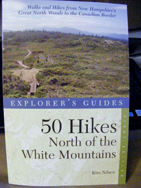
50 Hikes includes a map with each trail description, along with black-and-white photographs. (I'm flattered that Kim chose one of my own photos to illustrate the Prospect Mountain hike.)
A chart in the opening pages shows at a glance the distance and relative difficulty of the fifty hikes, along with notes about suitability for kids and availability of campsites.

I've written in my Cohos Trail journal about Kim's real masterwork, the Cohos Trail. Kim came up with the idea for the trail extending from Crawford Notch north to Canada, and he wrote the original guide to the trail. Now the Cohos Trail Association (www.cohostrail.org) is going strong maintaining the CT's 160+ miles. 50 Hikes includes many segments of the CT as dayhikes, and hike #50 is the full Cohos Trail in all its backpacking glory. The rest of Coos County is not neglected, however, with featured hikes for the Randolph area, the Dead Diamond district, Indian Stream, and Mt. Success.

From my own experience, I can give a few recommendations. The Falls in the River trail (#46 in the book) goes south from the Second Connecticut Lake dam on U.S. 3 in northern Pittsburg. It's a fairly level woods walk that leads to a beautiful flume of the Connecticut River, complete with ledges for a picnic stop. Mount Magalloway (#40) features the northernmost fire tower in New Hampshire, with correspondingly awesome views. The Pondicherry wildlife refuge in Jefferson gets its due in hikes #2 & #3.

Kim is generous with his time for anyone seeking information about New Hampshire's north country, as I learned as I was preparing for a backpacking trip on the CT a few years ago. All that generosity and love for the land comes through in his new book. Find it at your local bookstore (I picked it up at Toadstool Bookshop in Milford), or online at Countryman Press or Amazon.com.


Sunday, May 27, 2012

Odiorne Point State Park

This is the best piece of New Hampshire's eighteen-or-so miles of Atlantic coastline.  Those of you wanting a sandy beach & crowds can travel a few more miles south to Hampton. Odiorne Point is an altogether different experience. With a rocky shore, it's not a big sunbathing destination. What is has instead are trails, a boat launch, a salt marsh, dense woods, a science museum (separate admission), and a few World War II-era gun emplacements (!).  Check out the New Hampshire State Parks web page here for more information.

Located on Route 1-A in Rye, just south of Portsmouth & New Castle, Odiorne Point State Park has a $4-per-person admission fee whenever there's an attendant on duty, as on this Memorial Day weekend. Pack a lunch & enjoy the view to the Isles of Shoals from the picnic area. Bring bikes & strollers, since most of the paths are smooth & flat. The boat launch is a short distance north on Route 1-A from the main park entrance, if you want to bring your kayak. You'll want a camera as well, especially if you're a birdwatcher.

Somewhat hobbled by a tweaked knee today, I walked a slow circuit from the main parking area out to Frost Point, then past one of the concrete gun emplacements to the bike path along 1-A, which led me back to the parking lot. Lots of families were out & about, but there was no sense of being crowded. I was probably the slowest person in the park, and no one seemed to mind.

To get a sense of the different environments in this one small area, take an oceanside walk to feel the breeze & smell the salt air. Then walk away from the shore into the woods - and in just a minute, no more salt air. The fragrance of the woods is completely different. The shade will catch you by surprise, and so will the mosquitoes, unless you pack some bug repellent.

Flowers both wild & cultivated are everywhere. I'm fond of the wild roses that were blooming along the shore path. Clumps of iris stood near markers paying tribute to the park's history. They're not for picking, of course, but I have to admit I was tempted.

Roses along the shore

Monument to the area's first European settlers

Cool & shady path connecting shore trail with paved bike trail

Battery Seaman, a WWII souvenir, seaward view

Jetty at Frost Point, looking north to New Castle

Thursday, May 10, 2012

Gregg Trail: Wheelchair-Friendly, & Good Views for All

The Crotched Mountain Rehabilitation Center in Greenfield built two trails on its property in 2010 that are designed to be accessible for all, including people whose mobility is limited. One of the trails is a short loop around a wetland. I was there today for the longer trail: the Gregg Trail, .09 mile long, leading to a knoll with a view towards Mt. Monadnock. Other trails, rougher and more traditional, continue from there to the summits of Crotched Mountain.

Gregg Trail is wide, with an average 5% grade. Bring the whole family and take your time along the way. There are blueberry bushes all over the place, which of course did me no good today but should be perfect in July. Along the way, look east to the twin Uncanoonuc Mountains in Goffstown and the whaleback-shaped Joe English Hill in New Boston. As you approach the knoll, you'll see North Pack Monadnock and Pack Monadnock to the south. Finally, as Monadnock comes into view, you'll see all kinds of hills that will make you wonder what's what - and fortunately, there's an illustration nearby that names each peak.

No dogs allowed except for service animals. Sorry, Fido.

Head north out of Greenville center on route 31 and look for the blue Crotched Mountain sign at an intersection. Turn right and follow the road uphill about a mile and a half to the rehab facility, and you'll see the trailhead on your left. There are picnic tables and a porta-john along with a map kiosk at the trailhead.

Summit of Crotched Mountain, from Gregg Trail

View of Mt. Monadnock from end of Gregg Trail

Monday, May 07, 2012

Northwood Meadows State Park

Meadow Lake, Northwood Meadows State Park

Turtles basking in the mid-spring sun
No crowds here. Northwood Meadows State Park is the essence of passive recreation. The park is easy to find on Route 4 in Northwood. The main trail from the parking area is the north end of a 5-mile network of trails linking the park with other parcels of public land. Information  including a map link is here.

This is one of the newer state parks, and its wide & flat main trail was originally developed to be suitable for wheelchair users. The walk from the parking lot to Meadow Lake, this park's little jewel, takes only about ten or fifteen minutes at an easy pace.

This is an unattended park, with no staffer at the gate to collect a fee. I was surprised there was no box for donations, but perhaps security is a concern. I saw a few blazes & little cairns but no trail signs. Print out the trail map before you go; the map box was empty today.


Saturday, May 05, 2012

Ice Cream & Columbines on the NRRT

Back to the Nashua River Rail Trail today. This is still one of my favorite places, in all seasons. After a dry winter & early spring, recent rains have brought out the wildflowers along the trail, including the columbine pictured below that will be gone by my next visit. Today's walk was from Gilson Road in Nashua to Rt. 113 in Pepperell.
Trailside oasis in Dunstable

Basking turtle, trailside marsh

Rail Trail Ice Cream Stop, Pepperell: this is "Small"

Hardly any traffic on the trail today!

Columbine & bluets